ELR (Engineers Line Reference)
What is it
An Engineer’s Line Reference (ELR) is a short alphanumeric code, usually three letters (and sometimes followed by a digit), that uniquely identifies a defined stretch of railway route on the national network in Great Britain. Each ELR is tied to a continuous mileage chain, so that any combination of “ELR + mileage” points to one and only one location on the infrastructure.
An ELR is typically three uppercase letters, sometimes extended with a numeral when a long route is split into successive segments (for example, ECM1–ECM9 along the East Coast Main Line). The letters usually reflect the line name or endpoints (e.g. a main line or key junctions), and the code is treated as the official engineering identifier for that route section.
Why it matters
ELRs remove ambiguity where many different routes share the same mileages from different datum points, allowing precise identification of structures, signals and locations.
They underpin asset records, work orders, possession planning and safety documentation, ensuring that all parties refer to the same physical place when quoting a location.
Where it is used
ELRs appear in infrastructure databases, Table A of the current Sectional Appendices (the official, route-by-route reference document that describes the physical and operational characteristics of the railway infrastructure) and track diagram series such as the publications by Trackmaps (formerly Quail Maps).
The codes are also physically marked on items like bridges, culverts and some other structures, often alongside the mileage, so field staff can confirm the exact route and location on site.
For clarity, ELRs are also used to identify routes in the most technologically advanced rail infrastructure monitoring systems, such as AIVR.
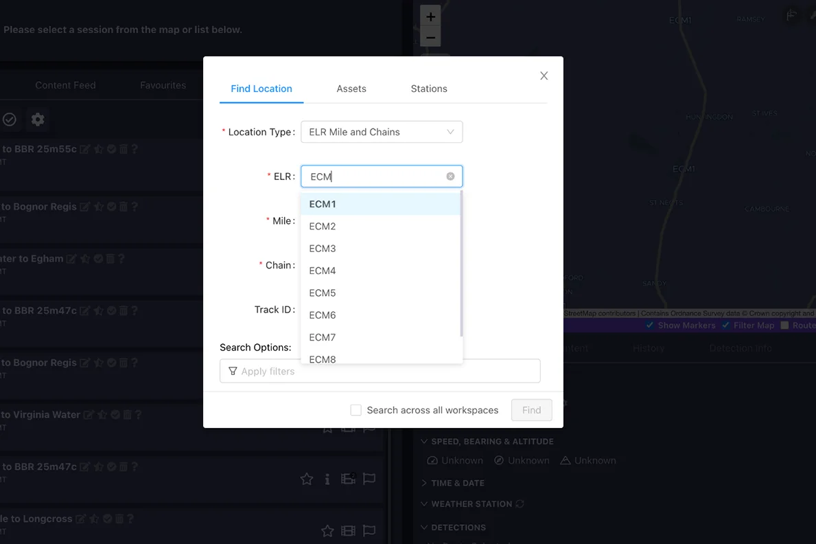
Search by ELR on AIVR to inspect your area of work.
Who uses it
Infrastructure managers (Network Rail and residual BR bodies), designers and maintainers use ELRs in asset registers, inspection reports and design drawings.
Train operators, operations planners and signalling staff rely on ELR-based references in notices, possession plans and incident reports to communicate locations unambiguously.
How it works
Each ELR defines a route with continuous, non-duplicated mileage; if the mileage scheme changes or would otherwise duplicate, the ELR is split or given a numeric suffix so that mileages remain unique within each code.
A full engineering location is therefore expressed as “ELR + miles + chains (or yards)”, for example “MLN1 112m 63ch”, giving a unique positional key that can be mapped into GIS, maintenance, and recording systems.