Chainage
What is it
Chainage in UK rail engineering is the linear distance measured along a defined track reference line from a fixed origin point, historically expressed in chains and now usually in metres, but the term itself has persisted from early surveying practice.
The word comes from the surveyor’s ‘chain’, a physical measuring-chain of 100 links, which measured 66 feet long (about 20.12 metres). Also known as Gunter’s chain, it was invented by English clergyman and mathematician Edward Gunter and introduced in 1620.
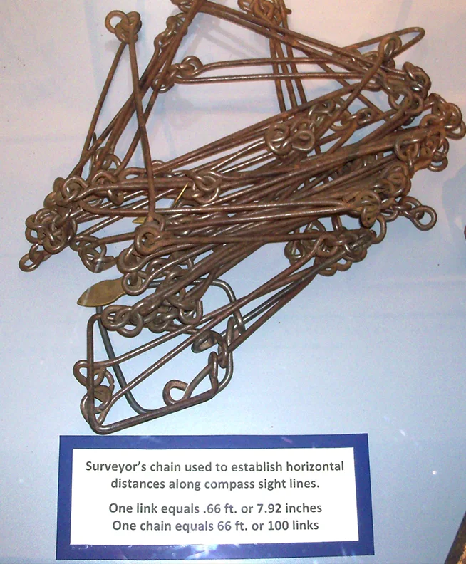
Surveyors’ chains were light and portable. Credit: Roseohioresident, Public domain, via Wikimedia Commons.
Chainage is still widely used in British land and railway surveying. On UK railways, positions were traditionally recorded as miles and chains, and although metric units and GIS are now common, the language of ‘chainage’ survives on drawings, records and in engineering practice. Even hi-tech remote infrastructure monitoring systems such as AIVR incorporate traditional chainage in their search, navigation and positioning functions.
Why it matters
Using chainage gives a simple, robust way to describe where things are along a route, which is often clearer and more stable than using raw coordinates.
Chainage provides a consistent linear reference so that any asset, defect, or worksite can be located unambiguously along a route, independent of changing landmarks or kilometrage posts. This allows precise communication between designers, surveyors, maintainers, and train operators when describing locations of bridges, signals, switches, speed restrictions or faults.
When: key dates
The underlying concept emerged in the mid-20th century, when C.H. Waddington’s wartime work on ‘condition-based’ strategies challenged time-based inspection in the RAF. Predictive maintenance as a distinct term gained traction from the 1960s to 1970s as industries adopted condition monitoring and prognostics, and spread widely with digital tools around the start of the 21st century. In rail, serious strategic focus on predictive and risk-based infrastructure maintenance has accelerated over roughly the last two decades.
Where it is used
In UK rail, chainage appears on alignment plans, track design models, signalling layouts and maintenance records to describe positions of features along each line. Similar concepts are used on roads, pipelines, and canals, where chainage defines locations along the project centreline for civil engineering and asset management.
Chainage as a concept is essentially the same worldwide but terminology, units, and conventions differ between countries.
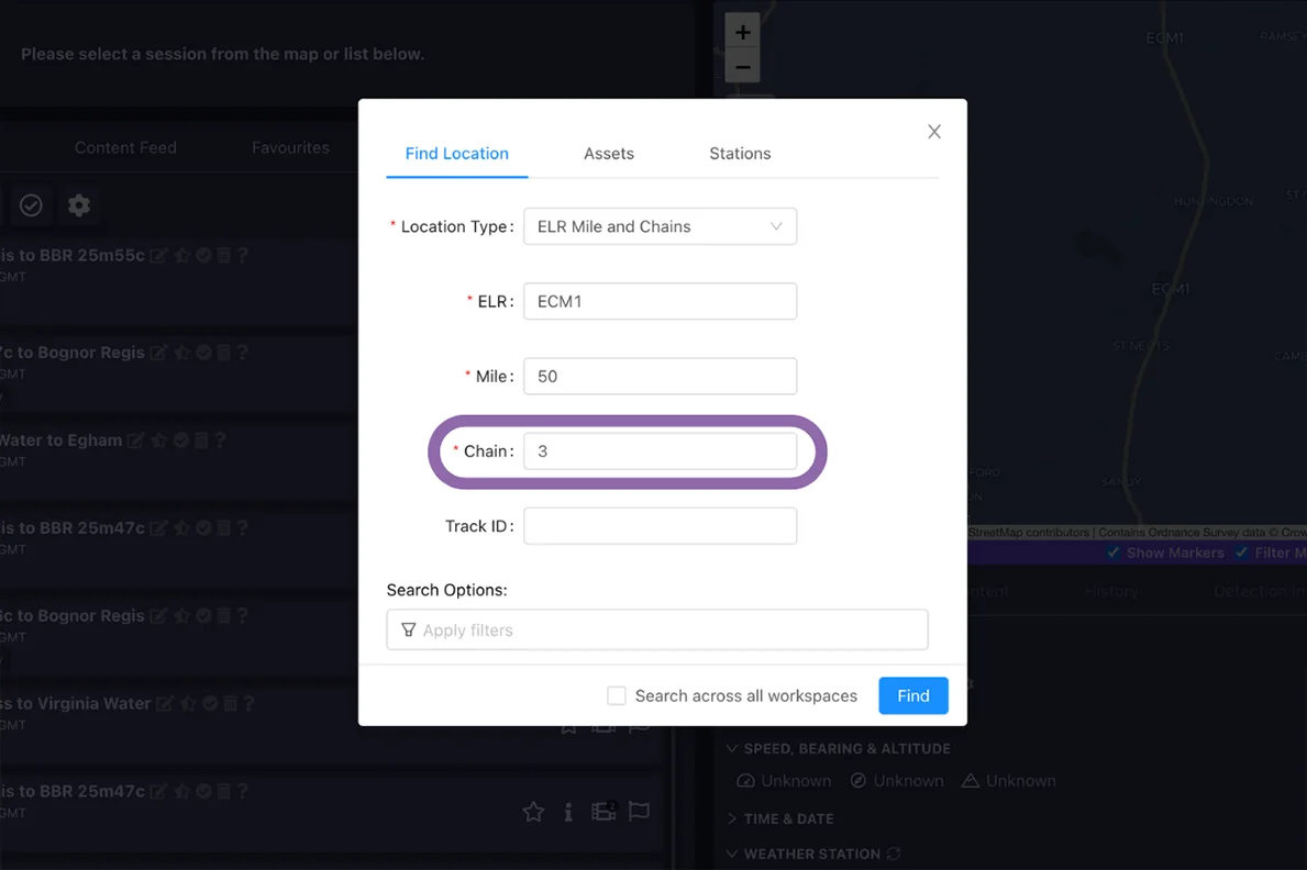
In AIVR, users can search by ELR, Mile and Chain to inspect their area of interest.
Who uses it
Railway designers, surveyors, and permanent way engineers routinely use chainage when setting out or modifying track geometry and structures. Operations, signalling and maintenance teams also reference chainage in incident logs, inspection reports and work orders to ensure everyone is talking about the same physical point on the infrastructure.
How it works
A reference baseline and zero chainage (for example, “0+000” at a terminus) are defined, and distance increases along the chosen direction of the line. Locations are then expressed in a standard format such as “189+400 km” or “112 miles 63 chains”, and modern systems may maintain multiple absolute reference chainages for different corridors, linked to grid coordinates for design integration.